Contact Marin Environmental History
We'd love to hear from you, please use this Contact form to reach us by email.
We'd love to hear from you, please use this Contact form to reach us by email.
A New Book by John Hart
A New Book by John Hart
It was the middle 1930s and the middle of the Depression. The National Park Service, in an expansive mood, was looking at the coastlines of the United States to find out what pieces of shore were still largely free of houses, roads, and resorts, and might be purchased as large federal parks. On the West Coast, one area stood out: a rural peninsula in Marin County, just north of San Francisco, called Point Reyes. “Here is found a great sanctuary of wild life and a vast potential treasury for recreation, so fine as to challenge written description,” said the 1935 report. “It seems almost a miracle that this choice area, thirty miles distant from the San Francisco metropolitan population of over a million persons, should still be virtually unknown.”
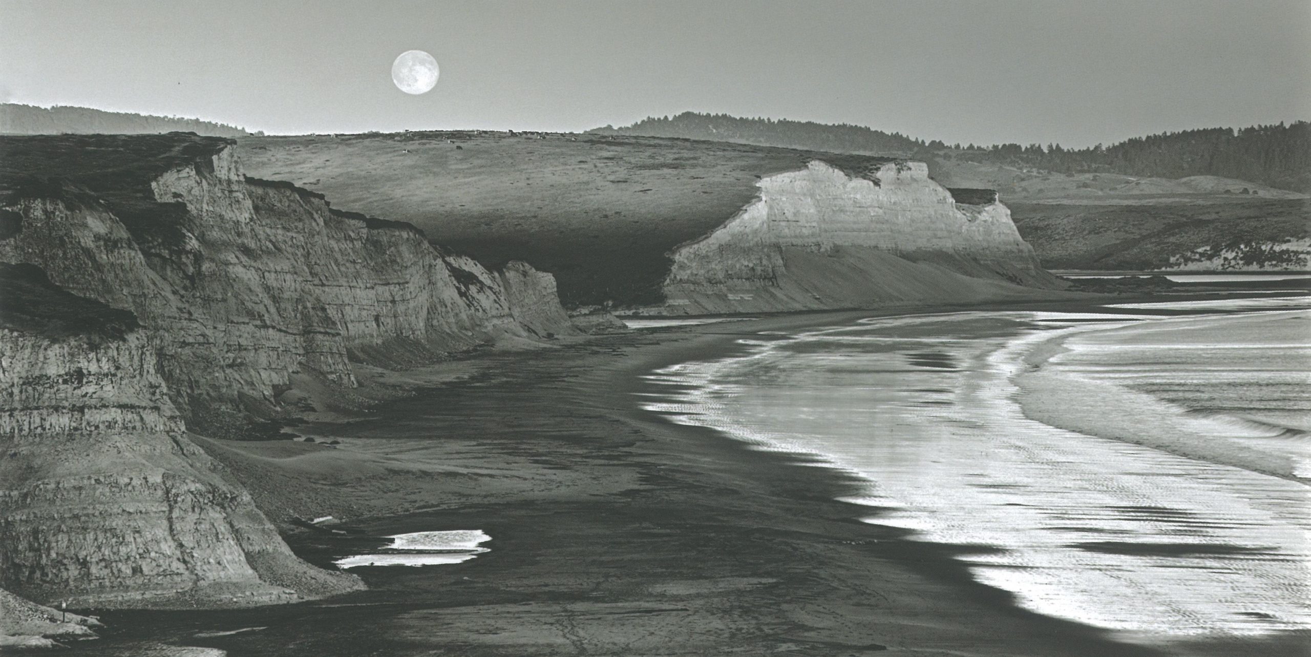
On a map, the Point Reyes Peninsula seems less a protrusion from the mainland than a foreign object sliding northward alongside it, perhaps a giant amphibious snail. It has a narrow leading edge and a blunt back end. A thickening in the middle, where the shell of the snail would be, produces the seaward promontory that Spanish mariner Sebastian Vizcaíno, sighting it early in 1603, named Punta de Los Reyes: the Point of the Three Kings.
The image of a sliding block does not deceive. The contact line between peninsula and mainland is the San Andreas Fault, a titanic fracture in the surface of the earth along which massive crustal plates are slipping. The land and sea bottom to the west are shifting northwestward at an average rate of almost two inches a year. The fault zone has created a long valley into which the sea fingers from either end, making Point Reyes a paene insula: almost an island. The long northern intrusion of salt water is Tomales Bay; the shorter southern lobe is Bolinas Lagoon. The trough between them is the Olema Valley, traversed by California State Route One, “the Shoreline Highway,” which here forgets the promise of its name. Leaving the fault zone to follow all the curves of the Point Reyes coast would make it at least 50 miles longer.